

When news reports show flooded cities, destroyed roads, and people leaving their homes because of rising water, the explanation is usually simple: heavy rain. But where does that much water come from in such a short time. Why does it pour for days in some places while others receive almost no rain at all.
It turns out that there are powerful flows in the sky that can carry enormous amounts of moisture across thousands of kilometers. We cannot see them, but they are often behind the most intense rainfall and floods.
How water moves through the atmosphere
There is always water vapor in the atmosphere. It forms above oceans, rivers, lakes, and forests. Evaporation is especially strong in warm regions, where large amounts of water rise into the air every day.
But this moisture does not stay where it forms. Winds carry it across oceans and continents. In some cases, these flows become stable and highly concentrated. Scientists call them atmospheric rivers.
What an atmospheric river is
An atmospheric river is a long, narrow stream of air filled with water vapor. It can stretch for thousands of kilometers and reach hundreds of kilometers in width. The amount of water it carries can rival or even exceed the flow of the largest rivers on Earth.
The difference is in its form. A regular river flows along the ground. Here, the water moves through the air.
A real example from South America
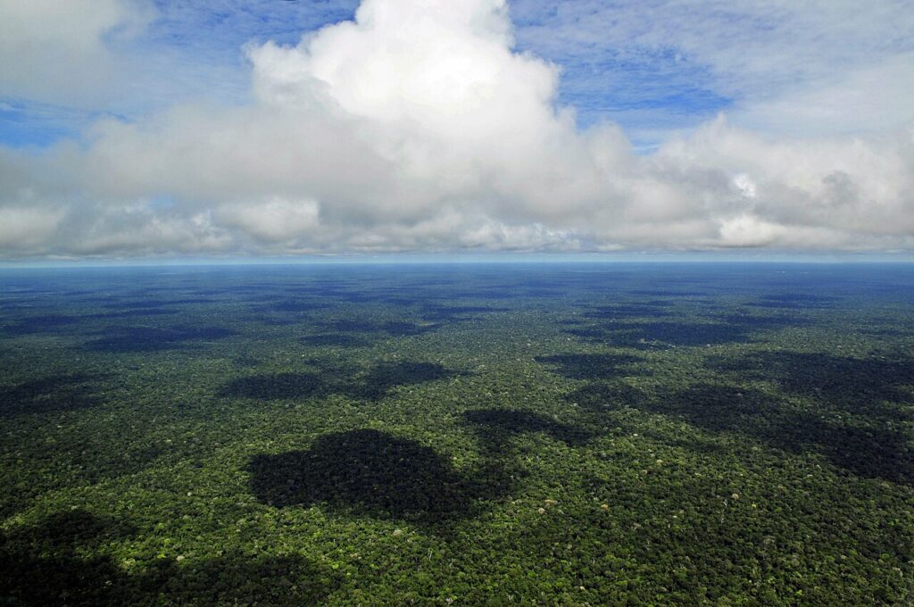
By Neil Palmer/CIAT – Flickr, CC BY-SA 2.0, https://commons.wikimedia.org/w/index.php?curid=28394053
The Amazon rainforest releases vast amounts of moisture into the atmosphere every day. Trees emit water through their leaves, creating a powerful flow of vapor.
This moisture is then transported deep into the continent. Scientists often refer to these flows as flying rivers. They bring rain to regions far from the ocean.
Without this process, large parts of South America would be much drier.
When this leads to disasters
The most visible effect of atmospheric rivers is extreme rainfall.
In 2017, a series of strong atmospheric rivers hit California, causing floods and damaging infrastructure. The ground could not absorb the amount of water, and rivers overflowed.
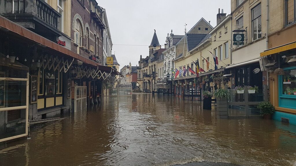
By Romaine – Own work, CC0, https://commons.wikimedia.org/w/index.php?curid=107588049
In 2021, heavy rainfall in Germany and Belgium led to devastating floods. Within a short period, an amount of rain fell that would normally be spread over weeks. This caused destruction and loss of life.
In Japan, similar processes regularly lead to intense downpours. Combined with mountainous terrain, this increases the risk of landslides.
In all these cases, the key factor was moisture transported from far away.
Where rain never seems to stop and where it never comes
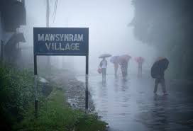
There are places where the impact of these atmospheric flows becomes especially clear. In the Indian town of Mawsynram, one of the highest rainfall levels on Earth is recorded. Moist air arrives from the Bay of Bengal, rises over the mountains, and releases constant rain during the wet season.
On the other hand, the Atacama Desert in Chile is one of the driest places on Earth. In some areas, rain may not fall for years. One of the reasons is that major moisture flows either pass by or are blocked by atmospheric and geographic conditions.
These extremes show that rainfall depends not only on local conditions, but on large scale movement of moisture.
Why this becomes a problem
Under normal conditions, atmospheric rivers are beneficial. They bring water, support ecosystems, and sustain agriculture.
But when a flow carries too much moisture or slows down over one area, the situation changes. Rainfall becomes intense, the ground cannot absorb the water, and flooding begins.
As the climate warms, the atmosphere can hold more moisture. This increases the strength of such events and makes them more noticeable.
Why we cannot see them
The main feature of these rivers is that they are invisible. Water vapor has no color and cannot be seen directly.
We only observe the result: clouds, rain, or snow. The flows themselves can only be tracked using satellites. From space, they appear as long bands of moisture crossing oceans and continents.
What this changes in our understanding
This phenomenon shows that water on Earth does not move locally, but globally. Rain in one place can depend on processes happening thousands of kilometers away.
Oceans, forests, and the atmosphere form a connected system. When one part changes, it affects the others.
Conclusion
Invisible rivers in the sky are a real mechanism that controls how water is distributed across the planet. They can bring life giving rain, or they can lead to destructive floods.
Understanding them helps explain why weather behaves the way it does and why it can sometimes exceed what we expect.
If you want to understand how these invisible flows turn into something we can actually see and feel, you can read The Cycle of Rain – When the Season Becomes a Ritual. It explains how rain forms and why it repeats as a pattern that shapes entire regions.
And if you want to keep exploring the beauty of nature, discover unusual facts, and learn more about the world around us, you can follow the Wonderful World Telegram channel.